Carnarvon* (Castle) - Nantlle
Date Closed to Passenger Services
12 Jun 1865
Mileage Closed
8m 0c†
Stations Closed
Carnarvon* (Castle); Bont Newydd; Pwllheli Road; Groeslon; Pen-y-Groes; Nantlle
Cobb Atlas Reference
329 48 62 - 48 52
Map
Further Notes
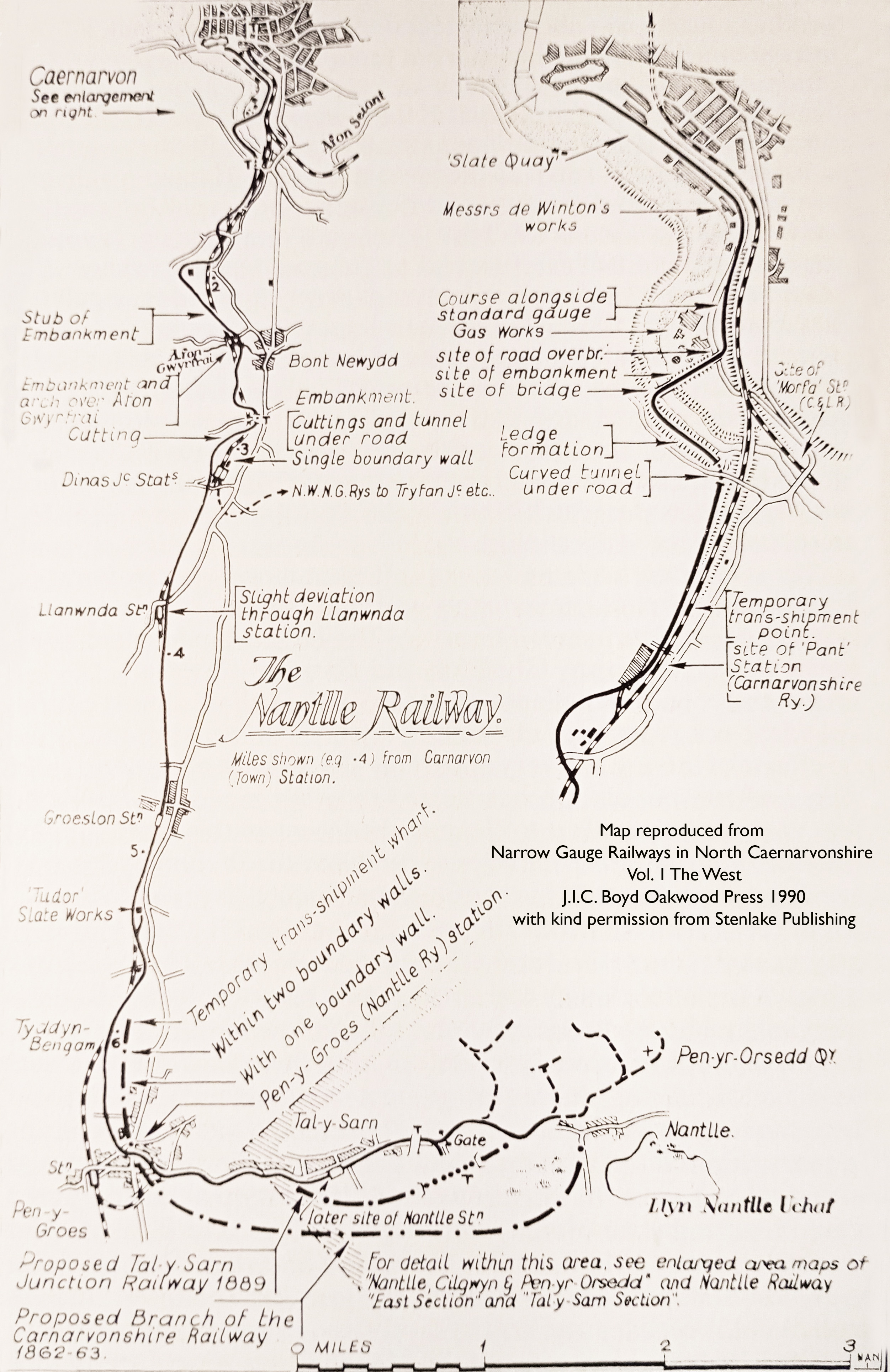
Nantlle Railway
Track gauge 3ft. 6in.; 1066.8mm
ACD - Mon 12/06/1865 - CPLGB p24; RPSGB.
Line closed to passengers to facilitate the rebuilding and conversion to standard gauge. Most of the route between Carnarvon (Castle) and Dinas Junction was on new formation. Conversely, most of the formation south of Dinas Junction to Nantlle was incorporated into the rebuilt railway. Rather than attempt to list these sections permanently closed by name, the details will be presented on a map which will be produced in the fullness of time.
See Afon Wen Jct. - Caernarvon (excl.) and Penygroes Jct. - Nantlle.
See Narrow Gauge Railways in North Caernarvonshire Vol.1 B5A OP 1990 for a detailed history of this railway.
*Spelling adopted at time of closure.
Page updated: 29/02/2024