Ashton Jct. - Dukinfield Jct.
Date Closed to Passenger Services
2 Jun 1902
Mileage Closed
0m 24c*
Stations Closed
-----
Cobb Atlas Reference
370 93 98; SJ 932 978 - SJ 934 982
Present Status
Dismantled
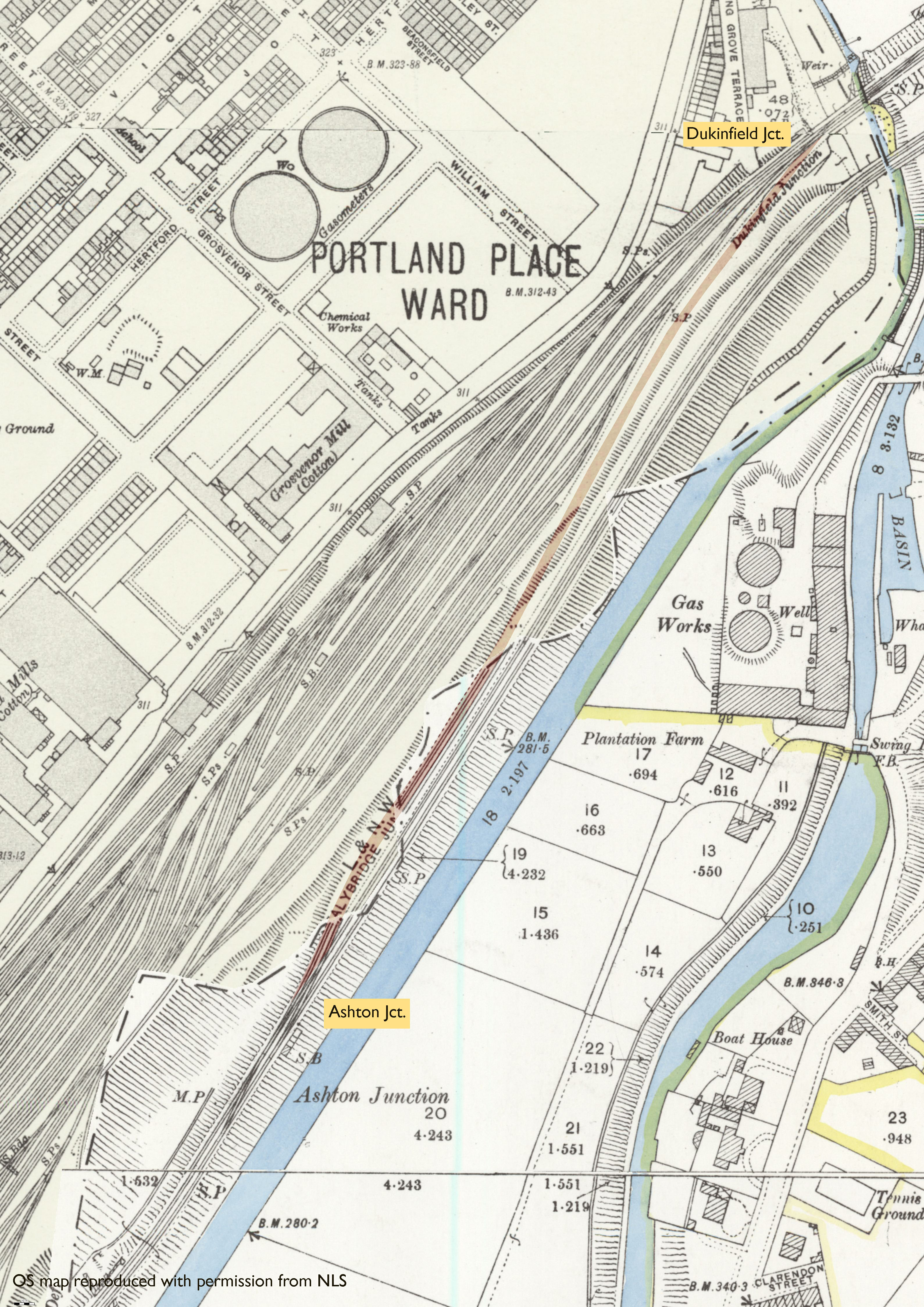
Map
Further Notes
ACD - Mon 02/06/1902 - C LNWR Ch.
*Mileage calculated using OS map measuring tool.
This section of line came to light when studying the above publication. At first, it appeared to refer to the N to E curve from Dukinfield Jct. - Ashton East Jct., but this line was not opened until 1905. Closer inspection of Cobb reveals a connection from Dukinfield Jct. on to the LNWR Stalybridge to Denton Jct. line at (presumably) Ashton Jct., opened 1882 and closed 1902.
I have not to date been able to identify a map showing this connection in use, but the OS 25 Inch, 1892-1914 map shows evidence of earthworks that would suggest the formation of this section of line. The Parliamentary & Municipal Borough Boundary runs through the site and the east side, presumably an earlier edition of the map than the west side, tantalisingly shows tracks on what would appear to be this section of line. But, it also shows that the sidings and loops on the GCR line have been created/extended, encroaching on the site of this line, suggesting this was the reason for closure. C LNWR Chronology also gives the line as closing completely on the same date which would lend further support to this theory.
I have included an extract of this map accordingly.
Subject to further digging. Any information welcome.
Page updated: 29/10/2023